


Source : INDIA TODAY NEWS
Satellite images from the Indian Space Research Organisation (ISRO) reveal towering cloud masses over the Arabian Sea and the Bay of Bengal, dumping intense rainfall across Maharashtra and West Bengal.
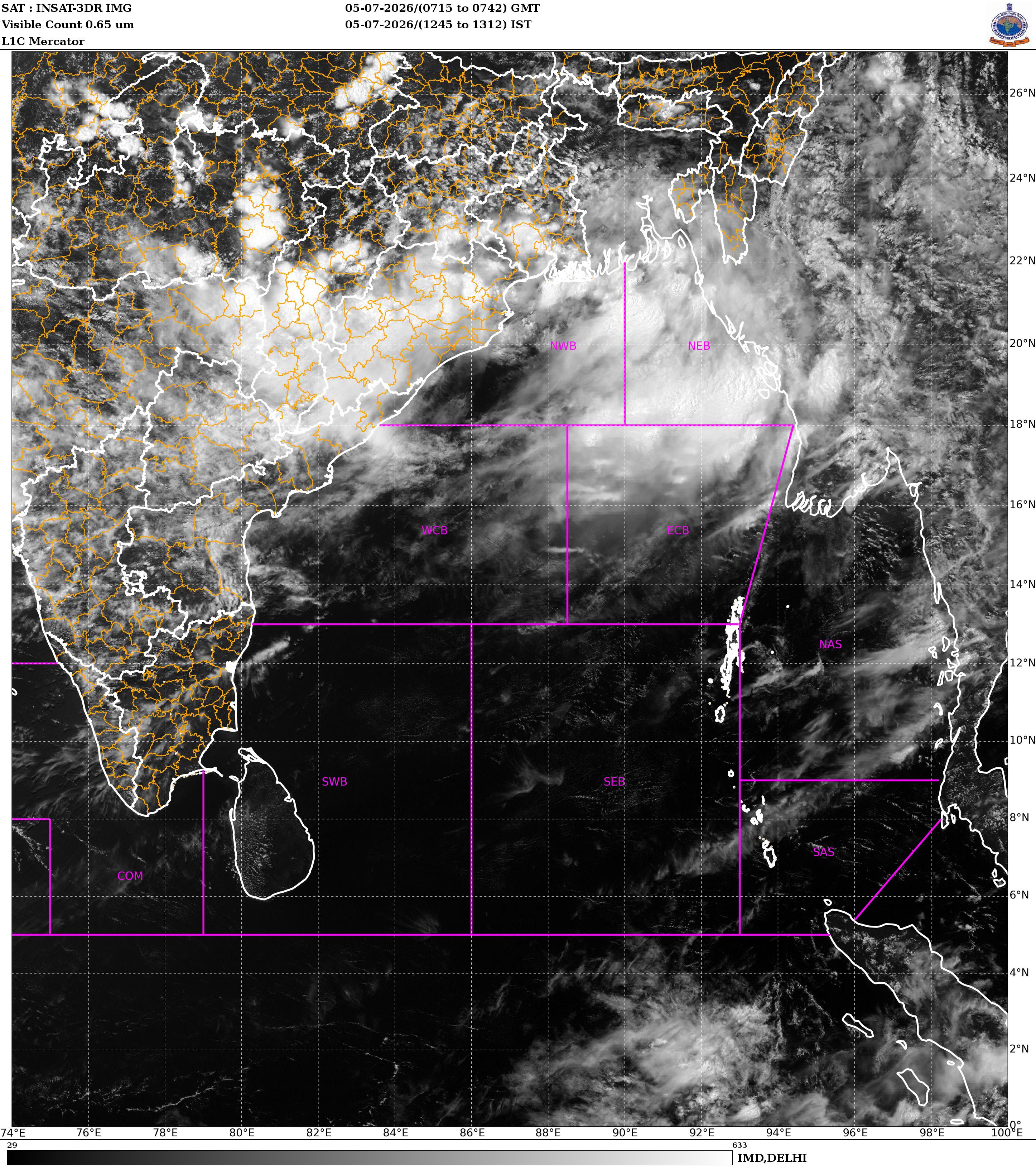
The latest INSAT-3DR satellite imagery shows a sprawling convective cloud system stretching from the east-central Arabian Sea into the Konkan coast, while another powerful system dominates the northern Bay of Bengal, extending across Gangetic West Bengal, Bangladesh and adjoining northeastern states.
advertisement
The cloud tops in both systems appear extremely cold and bright white in the infrared imagery, indicating deep convection and vigorous thunderstorm activity capable of producing heavy to very heavy rainfall.
HOW IS THE ARABIAN SEA CHURNING MONSOON FURY?
Over western India, the Arabian Sea weather system has intensified along the Maharashtra coast, feeding on warm sea surface temperatures and strong southwesterly monsoon winds.
The moisture-laden flow has generated widespread rain over Mumbai, the Konkan region and adjoining districts, with several places recording persistent downpours since morning.
Meteorologists say the active offshore trough along the west coast and continuous inflow of moisture from the Arabian Sea are sustaining the system, raising the likelihood of more spells of intense rainfall through the day.
Low-lying areas remain vulnerable to waterlogging, while commuters could face disruptions due to reduced visibility and flooded roads.
HOW IS THE BAY OF BENGAL PUSHING MONSOON DEEPER?
Eastern India is under the influence of an equally powerful monsoon system over the Bay of Bengal.
Satellite images show an expansive shield of dense clouds covering large parts of coastal Odisha, Gangetic West Bengal and Bangladesh, with embedded thunderstorm clusters indicating extremely heavy rainfall.
The weather system is being fuelled by abundant moisture from the Bay of Bengal and favourable upper-air circulation, allowing clouds to grow vertically into towering cumulonimbus formations.
As the system moves inland, it is expected to bring widespread rainfall across West Bengal, Jharkhand, Bihar and parts of northeastern India.
The simultaneous activity over both the Arabian Sea and the Bay of Bengal reflects a highly active phase of the southwest monsoon, with moisture streams from India’s two primary monsoon branches operating together.
The India Meteorological Department (IMD) has forecast heavy to very heavy rainfall over parts of Maharashtra, Konkan, Goa, Gangetic West Bengal and adjoining regions over the next 24 hours. Isolated locations could also witness extremely heavy rainfall accompanied by thunderstorms and gusty winds.

With the monsoon regaining strength after a sluggish start to the season, these twin weather systems have played a key role in narrowing India’s rainfall deficit over the past week.
However, forecasters warn that their intensity also raises the risk of urban flooding, landslides in hilly regions and disruption to transport services, urging residents in vulnerable areas to remain alert as the systems continue to evolve.
– Ends
SOURCE :- TIMES OF INDIA


