

Source : INDIA TODAY NEWS
As June began on Monday, much of India continued to witness busy weather activities across regions, as it has through May.
Rain fell across most of Lakshadweep, and in many places, including Andaman & Nicobar Islands, Uttarakhand, and Kerala.
Showers were also recorded in Assam, Meghalaya, parts of Uttar Pradesh, Himachal Pradesh, Vidarbha, coastal regions of Andhra Pradesh, Rayalaseema, Tamil Nadu, and parts of Karnataka.
advertisement
The highest single-station reading came from Eden Lauge in Nagaland-Manipur-Mizoram-Tripura (NM&T) subdivision, which logged 14 cm of rain.
But despite all the rain, India is yet to see the official arrival of monsoon.
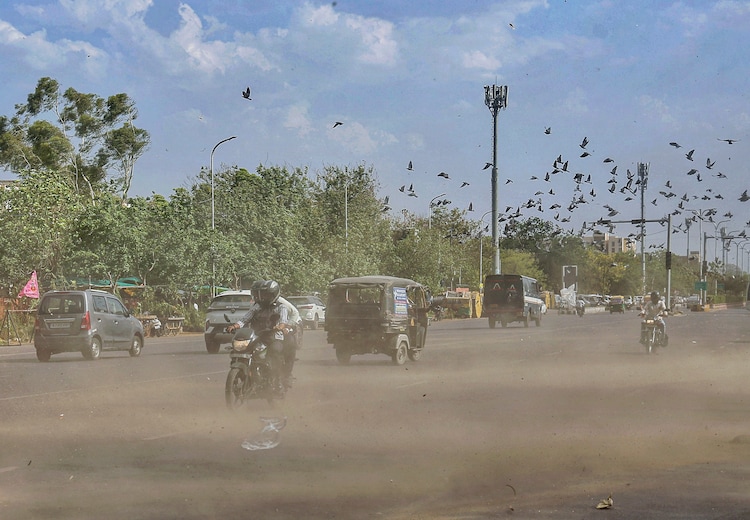
Meanwhile, at the other extreme, Gondia in Maharashtra recorded the day’s highest maximum temperature, a scorching 44.4°C.
In other words, India continued to see weather extremes in different parts of the country.
HOW WILL THE WEATHER BE ON TUESDAY?
Tuesday promises to be another eventful day across multiple regions.
Heavy rainfall is very likely in isolated places over the coasts of Andhra Pradesh, parts of Karnataka, Kerala & Mahe, Lakshadweep, Tamil Nadu, Puducherry, and West Madhya Pradesh.
Thundersqualls with winds reaching 50–60 kmph are very likely over coastal regions of Andhra Pradesh, Gujarat, Odisha, Rajasthan, and West Madhya Pradesh.
Parts of Madhya Pradesh are also bracing for isolated hailstorm activity, while Haryana and Delhi can expect thunderstorms with gusty winds of 40–50 kmph.
While the south and central parts contend with rain and storms, Northwest India faces a different challenge.
Temperatures across many parts of the region are forecast to rise by 4–6°C through the week.
Bihar is under a heatwave watch from June 2 onwards, with conditions very likely to persist right through June 7.
Hot and humid conditions on June 2 will grip parts of Arunachal Pradesh, Assam, Meghalaya, coastal Andhra Pradesh, Odisha, and Sub-Himalayan West Bengal, and Sikkim.

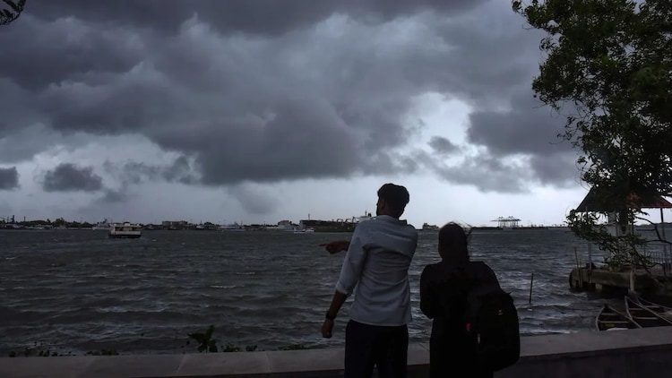
MONSOON ANOTHER STEP CLOSER
Amid all the weather extremes, millions continue to wait for the monsoon to arrive, which has so far been delayed multiple times.
Unsurprisingly, the evasive Southwest Monsoon continues to grab the attention across the country.
As of Monday morning, on June 1, the monsoon’s northern limit ran well south of the mainland, but conditions are described as favourable for its advance into parts of Kerala, Tamil Nadu, more of the Arabian Sea, and the Bay of Bengal over the next two to three days.
Although the monsoon has seen a delay from its already revised June 1 date, it’s now expected to arrive in the coming days.
The season is knocking away, and by most indications, it won’t wait long before making its presence felt along India’s southwestern shores, and then making its way north within weeks.
– Ends
SOURCE :- TIMES OF INDIA


