


Source : INDIA TODAY NEWS
The southwest monsoon has entered one of its most active phases this season, unleashing torrential rain across large parts of India.
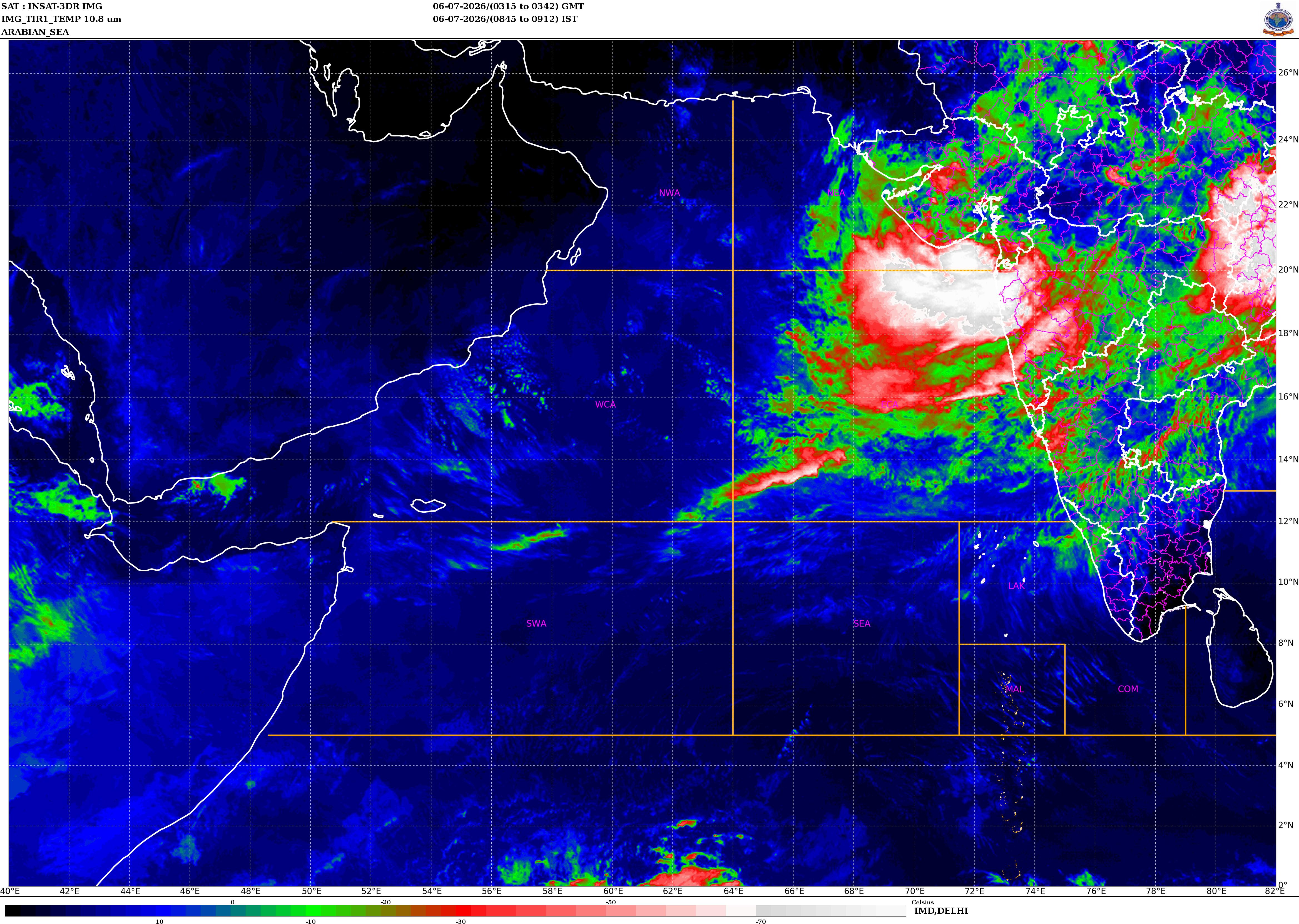
Fresh satellite images from ISRO’s INSAT-3DS satellite captured towering thunderclouds spreading across western, central and eastern India, as Mumbai, Odisha and West Bengal bore the brunt of relentless downpours.
The infrared imagery reveals an expansive shield of deep convective clouds stretching from the Arabian Sea across Maharashtra into central India, while another massive rain-bearing system dominates the Bay of Bengal and eastern India.
advertisement
The twin systems are feeding on abundant moisture from India’s two monsoon branches, triggering widespread heavy to very heavy rainfall.
Mumbai remains one of the worst-hit regions.
After days of incessant rain, the Brihanmumbai Municipal Corporation (BMC) declared a holiday for all government, private and municipal schools and colleges on Monday, July 6, following an Orange Alert issued by the India Meteorological Department (IMD).
The weather office has warned of intense rainfall accompanied by strong winds, with authorities urging residents to remain cautious. Although educational institutions will remain closed, government and private offices will continue to function.
The financial capital has witnessed repeated spells of heavy rain over the past several days, resulting in waterlogging, tree fall incidents and traffic disruptions across several parts of the city.
WEST BENGAL, ODISHA POUNDED BY MONSOON RAIN
While Maharashtra battles the Arabian Sea branch of the monsoon, eastern India is facing the fury of a strengthening low-pressure system over the northwest Bay of Bengal.
West Bengal is witnessing rapidly intensifying monsoon activity as the Bay of Bengal depression pushes inland.
The IMD has forecast heavy rainfall across Kolkata, Howrah, South 24 Parganas, Bankura and Purulia, along with thunderstorms and gusty winds reaching 40-50 kmph.
The impact is already visible in rainfall observations. Canning in South 24 Parganas recorded 37.2 mm, while Durgachak in East Midnapore received 34.2 mm. In North Bengal, Sevoke recorded 33.2 mm, Lava received 31 mm, and Siliguri measured 28.6 mm during the 24-hour period ending Sunday morning.
The system has also placed Odisha under a Red Alert, with widespread rainfall affecting districts from Bhubaneswar to Bargarh and Malkangiri to Mayurbhanj.
The state received an average rainfall of 26.5 mm during the last 24 hours against a normal of 9.4 mm, recording an extraordinary 182 per cent excess rainfall for the day.
The State Emergency Operation Centre (SEOC) remains on round-the-clock alert while district administrations continue to monitor flood-prone areas amid persistent rainfall.
Meteorologists say the active phase of the southwest monsoon is likely to continue over the coming days as moisture from both the Arabian Sea and the Bay of Bengal continues to fuel widespread thunderstorms and rain bands across India.
With rivers rising, urban flooding increasing and more heavy rain forecast, authorities have urged people in vulnerable regions to stay updated with weather advisories and avoid unnecessary travel during periods of intense rainfall.
– Ends
SOURCE :- TIMES OF INDIA