Source : INDIA TODAY NEWS
Three possible explanations have emerged for the devastating flash flood that struck northern Nepal on Wednesday, while authorities in India remain on alert as the floodwaters move downstream through the Narayani-Gandak river system.
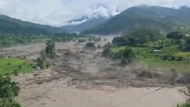
A wall of water swept through northern Nepal from Tibet, killing people and damaging bridges, roads and hydropower infrastructure across Rasuwa, Nuwakot, Dhading and Chitwan districts before sending a surge downstream towards India.
advertisement
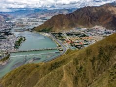
India Today’s Open-Source Intelligence (OSINT) team geolocated three major damage sites and traced the flood’s path from Tibet into Nepal and further downstream towards India. The locations include Rasuwagadhi at the Tibet border, New Trishuli Bridge in Nuwakot and Malekhu Bridge in Dhading.
The flood appears to have originated along the Lhende River in Tibet before entering Nepal’s Rasuwa district shortly before 9 a.m. on Wednesday. However, the precise trigger remains under investigation.
WHAT CAUSED THE FLOOD?
Three possible explanations have emerged, based on assessments by Nepali authorities, although the exact sequence of events is yet to be established.
The first theory is that an avalanche blocked the river upstream before the accumulated water suddenly broke through.
“The river was blocked by an avalanche. The flood is expected to have occurred suddenly after the river opened in Tibet,” Nepal’s National Disaster Risk Reduction and Management Authority (NDRRMA) spokesperson Shanti Mahat told Republica.
A subsequent NDRRMA assessment based on Planet Labs satellite imagery pointed to a snow-and-rock failure around 20 km northeast of Rasuwagadhi. The authority said an ice/snow-rock landslide had triggered a debris-laden flood in the Lhende River.
While the assessment suggests a glacial or cryospheric component, the satellite imagery released so far shows a sudden expansion of the river channel and widespread debris inundation. It does not independently confirm the existence of a glacial lake or prove that a glacial lake outburst flood occurred.
A second explanation links the disaster to a magnitude-4.4 earthquake recorded shortly before the flood.
Nepal’s Foreign Minister Shishir Khanal told Parliament that preliminary information indicated an earthquake occurred at 8:37 a.m., triggering an avalanche that subsequently led to the flood. He cautioned that the information still required verification.
The third possibility is a glacial lake outburst.
Senior meteorologist Min Kumar Aryal of Nepal’s Department of Hydrology and Meteorology told state-run Rastriya Samachar Samiti that the flood was unlikely to have been caused by rainfall, noting that precipitation in parts of Rasuwa had remained below 7 mm in the preceding 24 hours. He said authorities suspected a possible glacial lake outburst and were investigating the possibility.
For now, Nepali authorities agree on one key point: the disaster was triggered by an upstream event near the Tibet border. Whether that event involved an avalanche, an earthquake-triggered ice-rock collapse, a glacial lake outburst or a combination of factors remains unclear.
WHY IS THIS A CONCERN FOR INDIA?
It is too early to assess the full downstream impact in India. However, hydrologists say one key river connection cannot be ignored.
The Trishuli River is part of a larger river network. At Devghat, it merges with the Kali Gandaki to form the Narayani River, carrying any major surge further downstream.
The Narayani then enters India near Valmikinagar in Bihar, where it becomes the Gandak River.
This does not mean flooding in the Trishuli will automatically result in flooding in India. However, it places districts along the Gandak basin under close watch because they are the most directly exposed to any significant flood wave originating upstream in Nepal.
The Central Water Commission has advised authorities in Bihar and Uttar Pradesh, particularly in areas along the Gandak near the India-Nepal border, to remain alert and closely monitor water flows.
Bihar’s Disaster Management Department said the situation was being monitored because of the flash flood in the upper Gandak catchment area in Nepal and the possibility of a sudden increase in river discharge.
West Champaran is the first major Indian district along the flood’s projected path. East Champaran, Gopalganj, Saran, Muzaffarpur and Vaishali have also been placed on heightened alert.
“The entire disaster management team is on high alert in view of the potential threat of floods,” Bihar Disaster Management Principal Secretary Santosh Kumar Mall told ANI.
NDRF teams have been deployed in Bettiah, Gopalganj and Muzaffarpur, while SDRF personnel have been stationed in vulnerable locations.
Uttar Pradesh authorities have also issued alerts in Maharajganj and Kushinagar districts. The wider Gandak basin extends into Deoria, where increased flows from Nepal can aggravate monsoon flooding.
The Gandak eventually joins the Ganga near Hajipur and Sonepur, although the flood peak is expected to weaken as it travels downstream.
Other major river systems in the region, including the Kosi, Bagmati, Burhi Gandak and Ghaghara, are not directly connected to this flood event.
For Indian authorities, the immediate focus remains on monitoring water levels along the Gandak basin as the flood surge moves downstream from Nepal.
– Ends
SOURCE :- TIMES OF INDIA